Sydney sits on a complex geological framework where Triassic Hawkesbury Sandstone overlies older Narrabeen Group sediments, often capped by Quaternary alluvium in the Parramatta River valley and Botany Sands district. AS 1726:2017 sets the standard for geotechnical site investigation, and seismic tomography is the only method that delivers continuous P-wave velocity profiles across these transitions. We deploy 24-channel seismographs with 4.5 Hz geophones spaced at 2 m intervals, generating velocity cross-sections that map the bedrock interface with sub-metre resolution. This data directly informs foundation design parameters, particularly where variable depth to rock affects pile termination levels. For large infrastructure projects, combining seismic tomography with calicatas exploratorias provides a dual validation of subsurface conditions.
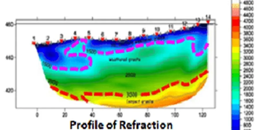
Seismic tomography in Sydney resolves the bedrock interface with sub-metre accuracy, critical for pile design in variable Hawkesbury Sandstone.